Wow! We had a couple of very scary hours here tonight. I didn't even know we had severe weather in the forecast, but around 8:45 this evening I heard the storm sirens sound. When I turned on the news they said there was a possible tornado on the ground near 82nd street and Allisonville Road, which is VERY close to my Dad's house. So Dad and I headed down to the lowest level of the house, and just after we got down there hail started hitting the roof. It was so loud we couldn't even hear each other talk. It lasted about three minutes and then it got very windy and the house started popping. Something very loud landed on the roof, probably a large tree limb.
There is damage all around town, but they really won't know the extent until tomorrow when they can go out and inspect the damage patterns. It looks like Dad has sustained some roof damage and there is a lot of debris in his yard. There was so much hail his entire yard was white! I will go up on the roof tomorrow morning and take a look. I called Cory my roommate and he said my neighborhood has damage as well, but it appears my house is okay. The amazing part is we never lost our power! Dad kept wondering when it would go out and I told him not to even think about it much less talk about it, or else he'll jinx us! We usually lose our power here every time a bird farts. It doesn't take much at all. But somehow it stayed on tonight, so that was good.
 http://www.theindychannel.com/news/19612463/detail.htmlDamage Reported As Severe Storms Move ThroughNWS Receives Numerous Reports Of Funnel CloudsINDIANAPOLIS
 -- Severe thunderstorms dropped at least one possible tornado and prompted numerous reports of funnel clouds across portions of central Indiana Saturday evening.
Tornado warnings were issued for two storms that formed north of Indianapolis at about 8 p.m.
Police reported a tornado on the ground near Lapel, about 13 miles west of Anderson just before 9:30 p.m., but no significant damage was reported.
Tipton County authorities said that one person was trapped in a damaged building near the Hamilton County line, but that person got out safely. Information about the extent of the damage wasn't immediately available.
Two storms prompted tornado warnings -- one in southern Hamilton and northern Marion counties and another in Tipton County. The storms moved southeast at about 35 mph and prompted additional warnings along their path.
Trees and large limbs were downed near the Mt. Comfort exit along Interstate 70, and a 70 mph wind gust was reported as storms moved through Montgomery County.
Severe thunderstorm warnings were issued for several other counties to the northwest of Indianapolis as a line of storms began forming and pushing southeast.
Additional warnings were issued south of Indianapolis as the storms headed that way.
Trained spotters reported funnel clouds and wall clouds across Boone County just after 8 p.m., which prompted the first warnings of the evening. A funnel cloud had also been reported in Clinton County, the NWS said.
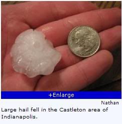
Large hail reports were received from Lawrence, in Marion County, where hail up to 1.75 inches in diameter fell, along with additional large hail reports in Shelby, Fountain, Howard, Boone, Carroll, Hancock, Hendricks and White counties.
Severe thunderstorm watches were posted for central and southern Indiana through the evening hours.


 Topic: Messages From The Heartland (Read 3542313 times)